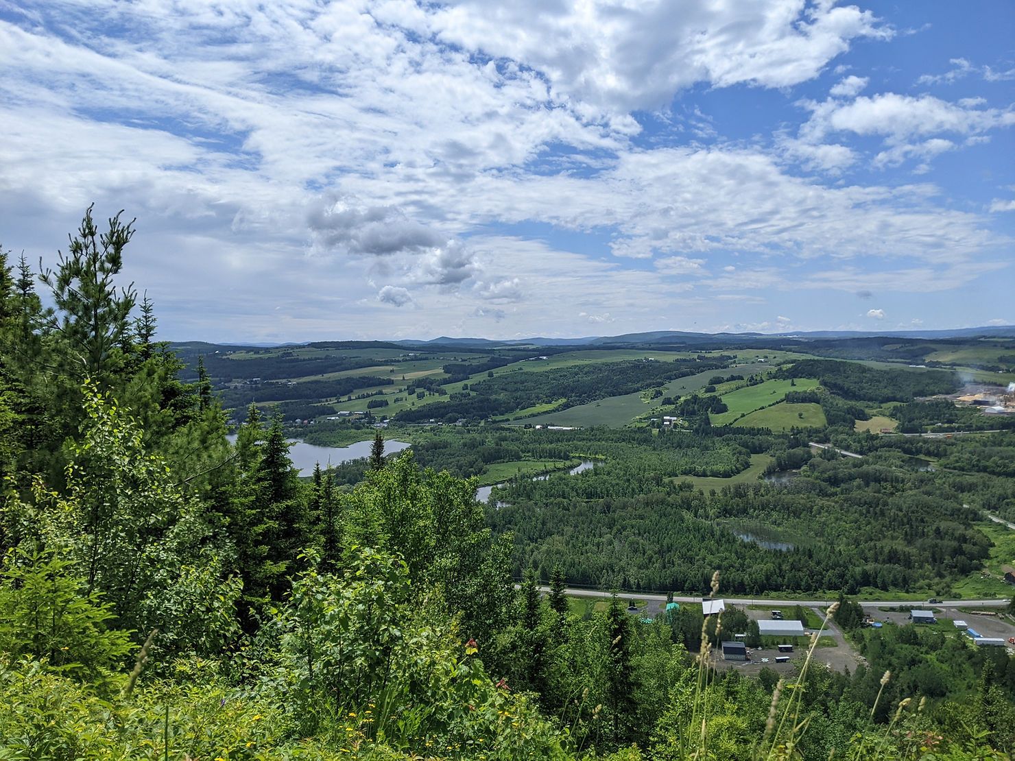
It was a rainy morning, but the rain was light and I could at least get ready and have breakfast in the dry abri. The first few kms were still along the river bank and ended near a site called ‘Les Marais’ where there’s a salmon research station and a barrier where you can also see salmon jumping. I stopped to watch some men pulling a contraption out the water, which turned out to be a camera that counts the fish, except it had stopped working. As I was standing there, I saw two salmon jump in the water even though I wasn’t at the barrier. I decided to go do the little loop to the barrier, but I didn’t linger long at the barrier given the rain and that it was chilly when I stopped walking, so I didn’t see any more jumping fish. After Les Marais, the trail follows dirt roads. At some point, I reached another point where I could either follow the GPS map or follow the trail markers. Since the map way had a sign saying ‘private property’ and following the markers worked out last time, I opted for the latter. At one point, the trail turned off the road and into a field. I was keeping my phone in my Ziploc ‘wallet’ to keep it dry from the rain and when I turned into the field, I pulled out my phone to check the map to see if I could get an idea of where the markers were taking me. For some reason, I pulled out the phone again a minute later and realised that my credit card wasn’t in my Ziploc. I went back to the road looking for it, but didn’t find it and wasn’t 100% sure if I’d just dropped it recently or dropped it earlier. I thought about how far I was willing to go back looking for it and decided that I didn’t really need it, I had a debit card and some cash and I could cancel the card next time I had cell reception. The other thing that wasn’t great, was that the markers led to an abri that according to the map was 2km off trail. So following the markers added about 4 unexpected kms to my day, not great for my sore ankles and feet. At least, the trail wasn’t too difficult, as it was following dirt roads and atv tracks after the abri. I stopped for lunch at a place called ‘Mt Tambour’ that seemed to be a launch site for hang-gliding and had a view of the town of Lac au Saumon in the valley below.
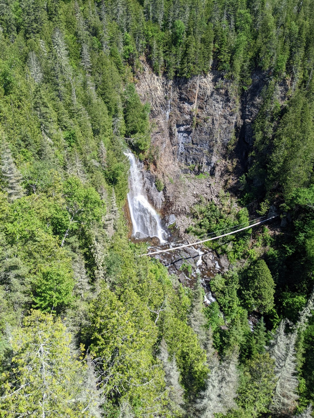
The sun came out and I took advantage to dry off my rain gear and dry my feet a bit. After lunch, the trail led to a highway and I thought the trail marker indicated to walk down it, so off I went down the hill along the shoulder. I didn’t go very far before it dawned on me that something wasn’t right. I checked the map and sure enough, I was going the wrong way and had to hike back up the hill. I didn’t go look at the markers again, but I think that there’s a shelter in the Lac au Saumon that’s a few kms off trail and the marker must have been for that shelter, which I wasn’t planning to stay at. Just slightly up the road from the misleading marker was the correct turn off, which takes you down a dirt road to a parking area for Chutes au Philomène. I did the short detour to go look at the 30m high waterfall, which has one of these platforms with a see-through floor over part of it. There also seemed to be a suspension bridge in front of the fall and a trail that went all the way down to the bottom, but I decided to skip these to avoid any more extra ascent and descent.

After more dirt roads and atv trail, I made it to Abri l’Érablière, which was on a small lake. The site also included a tent platform, but I opted for the abri since the last forecast I’d seen had shown that it was supposed to be quite chilly that night. Most of the abris had these fake wasp nests that were supposed to keep wasps from making real nests in them. I could see how they were needed, as the abris aren’t complete sealed and at this one, a few wasps did get in and buzz around until I shooed them out.

Leave a comment