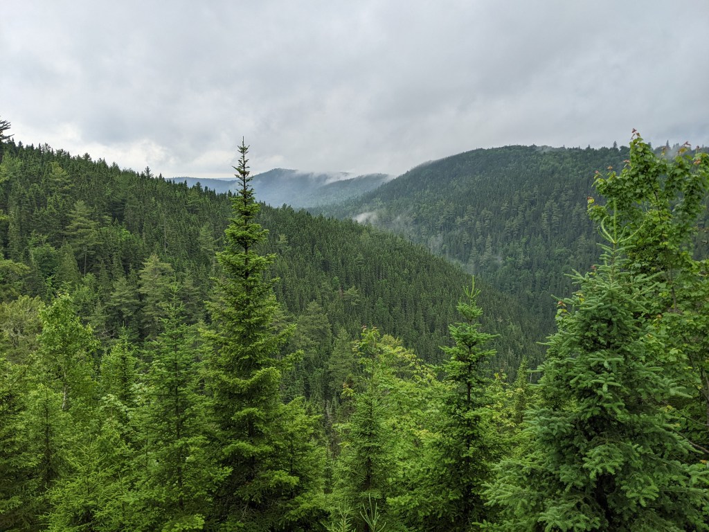
It was very overcast when I got up, but not raining. I got up early, 5:45, since I had a long day ahead of me but didn’t manage to get packed up until about 7:30. The privy was an open-air affair although there was still a gate to put down when occupied to stop someone else from ‘walking in’ on you. The mozzies were out in full force and I wore my rain gear to protect me, even though it was muggy. I arrived at the refuge le Corbeau, about 10 km away, at about 10 am, following a mix of dirt road, atv trail and hiking trail. The refuge is lovely, perched on a hill with a view into a canyon below. It was cloudy so I didn’t get the full view, but I could see how nice it would be. It was also blissfully free of mosquitoes.
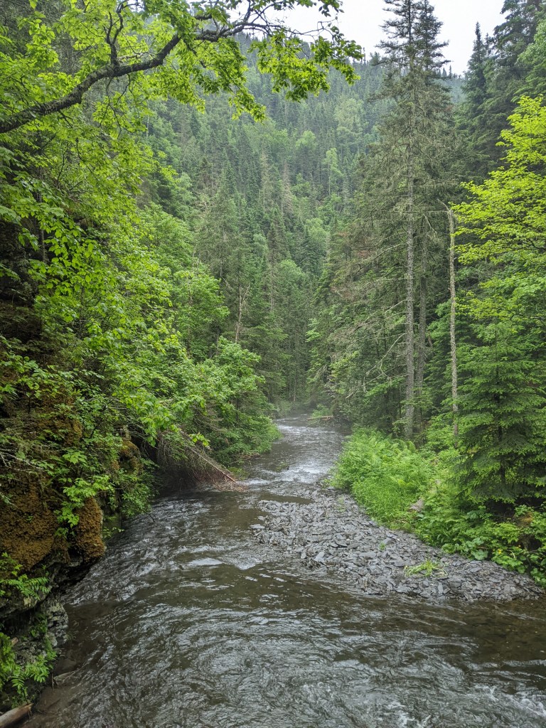
As I finished my granola bar, some thunder started rumbling around, but the storm never made it to where I was. It was then a steep downhill into the canyon, Canyon Clark, for a couple of kms along the stream at the bottom of the canyon. It was very technical with scrambles, eroded banks and slippery rocks and roots underfoot. At certain points the only way forward is through the stream, which was about knee deep. It took me about 1.5 hours to do the 2.5 kms.
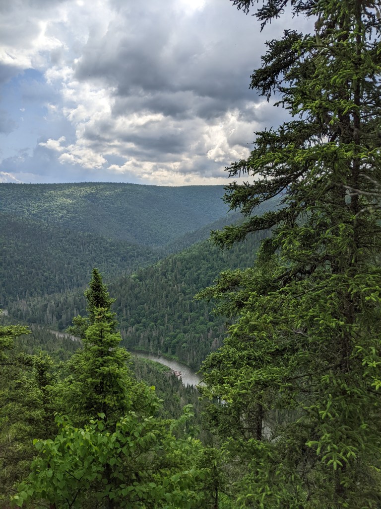
After a steep uphill out of the canyon, the trail got easier as it followed a grass covered atv road. That afternoon, the thunder started up again and both times I did get the hit by the storms, but they were short-lived and then the sun came out and was broiling. So I didn’t think to hard when the trail dead-ended at the Assemetquagan river. I know that the trail crossed the river at some point and figured it must be here and although it looked wide and swift, I plunged right in without looking at my map. I followed the advice seen on Youtube and unbuckled my bag, faced into the current and made sure to plant my trekking poles and move my feet slowly, one at a time. It got about mid thigh deep and the current was definitely strong, but I made it across safely. I couldn’t find the trail though once on the other side and after looking up and down the bank a bit, I pulled out my map. To my horror, I realised that this wasn’t where the trail crosses the river and that I had to go back. In I went again and back across, thankfully again without any issues. I felt really dumb when I found that some jungle-like ferns were hiding the path that turned and followed the river bank. I guess the trail marker was hidden somewhere in all that vegetation. I had a few more kms to go before getting to refuge Quartz and although it was pretty flat terrain, it was fighting through the jungle of ferns and scratchy plants on an eroded trail. I finally made it and at first thought I had company since there was a pair of socks on a line outside the hut, but someone must have forgotten them since there was no one there. I set up my tent on a platform, with two to choose from, since the hut was a bit dilapidated and rumored to have mice. To top off the day, I managed to fall by slipping on a log as I got of the platform and went down on one side, scrapping my thigh and back. At least there were no bugs, it was a beautiful cloudless evening and I had the sound of the river to lull me to sleep.

Leave a comment